Loading... Please wait...


Tech Specs
| Specification | Value | |
|---|---|---|
| Input Voltage / Power | 44-57V / 350mA Power over Ethernet | |
| Size | 4.5” x 7.5” x 14.8” | |
| Weight | 425 grams | |
| Receive | ||
| MTL 1090MHz Dynamic Range |
-88dBm -79 to 0dBm |
|
| MTL 978MHz Dynamic Range |
-93dBm -90 to -3dBm |
|
| Interface | Ethernet (JSON UDP) Compressed VRS (Virtual Radar Server) |
|
Networkable
Weatherproof
978/1090 ADS-B Receiver
Gain trusted situational awareness of surface and airspace ADS-B traffic with pingStation 2.

Dual-band
ADS-B Reception
pingStation 2 receives both ADS-B frequencies (978MHz UAT and 1090MHz) simultaneously with a single installation, enabling you to track aircraft equipped up to 200+ miles away.
MLAT Capable
pingStation 2 is MLAT Ready1. The internal GPS provides high-resolution timestamps for each message received. This allows a pingStation 2 sensor constellation to be used to multilaterate on Mode S transponder traffic, using time-difference-of-arrival (TDOA) to calculate aircraft positions.
1 Requires 3rd-party multilateration software

pingStation in Use

Airspace Surveillance
See how pingStation is being used in the UK to provide a Flight Information Display (FID) to Class G airports to improve situational awareness and reduce the risk of mid-air collisions.

UAS Detect and Avoid (DAA)
pingStation is a core component of the Vantis UAS Beyond Visual Line of Sight (BVLOS) network, and of the NUAIR 50-mile UAS Corridor between Syracuse and Rome NY.
Airport Surface Monitoring
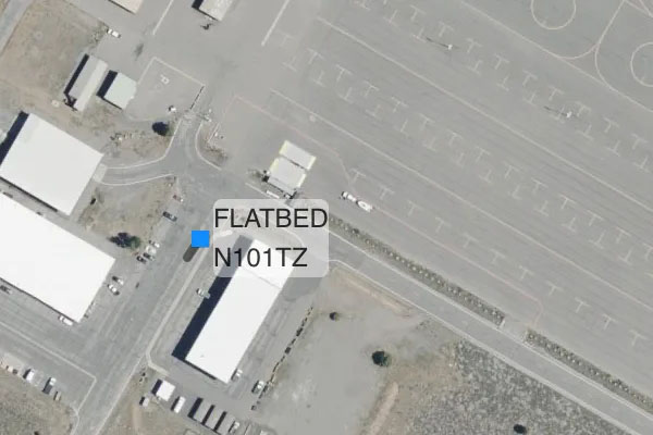
pingStation helps airports monitor and track operating surface vehicles equipped with VTU-20, reducing risk of runway incursion errors.
Easy to Deploy
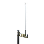
Say goodbye to difficult coax cable runs that reduce your reception performance. The all-in-one pingStation 2 includes the receiver, GPS, and antenna in a weatherproof enclosure, with power and data provided by a single Power-Over-Ethernet (POE) network cable connected right to your LAN. The quick pole-mount clamp design makes installation a snap.

Your Data, Your Way
pingStation 2 provides data in multiple formats easily integrated into any display or analytical application, including UAS Ground Control Stations, Unmanned Traffic Management (UTM) Solutions, and Flight Information Displays.
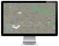
Virtual Radar Server
VRS is an open-source application that runs on a local machine or on a web server, providing airspace situational awareness and map customization options.

IRIS UAS
IRIS UAS by Kongsberg Geospatial is a situational awareness platform developed to provide Unmanned Aerial Systems (UAS) operators with the necessary situational awareness to safely operate Unmanned Aerial Vehicles (UAVs) Beyond Visual Line-of-Sight (BVLOS).
Custom Development
Need to integrate with a custom platform? No problem, pingStation 2 data messages are available in JSON or Compressed VRS format for developers.
Supporting Documentation:
Related Products
-
 pingStation 3 $5,180.00
 -
 pingStation1 $1,500.00